
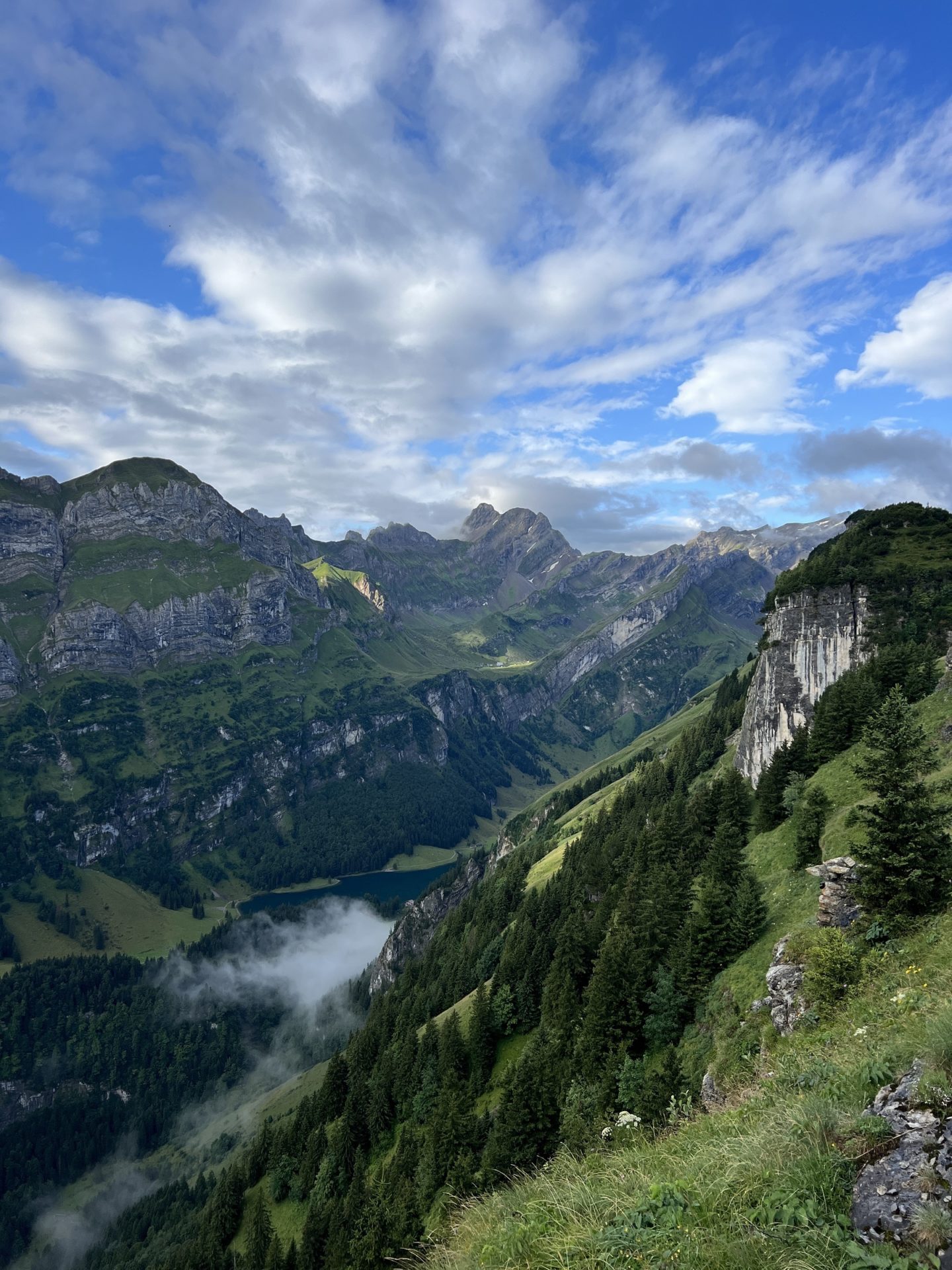
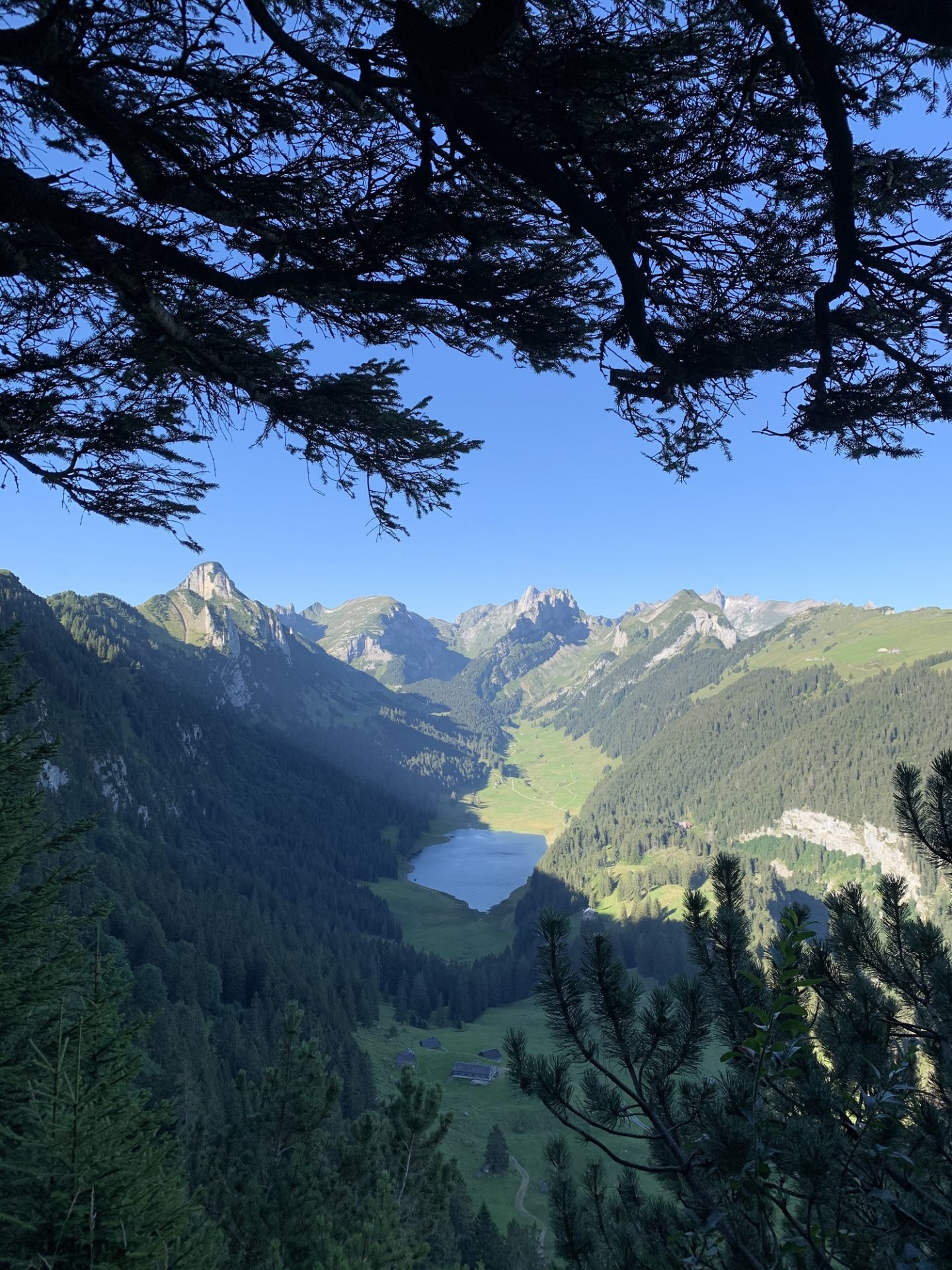
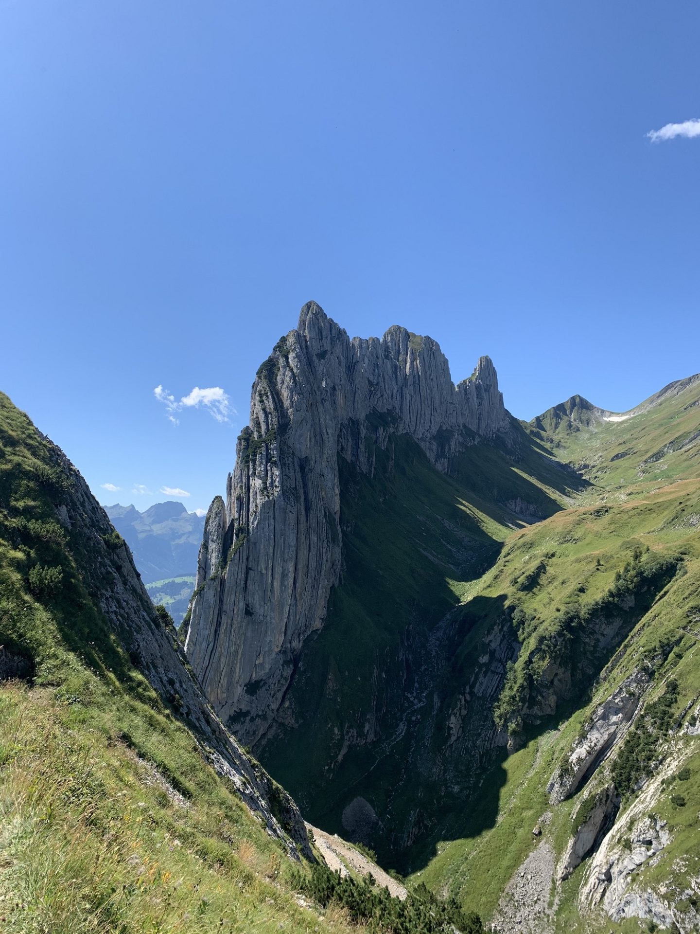
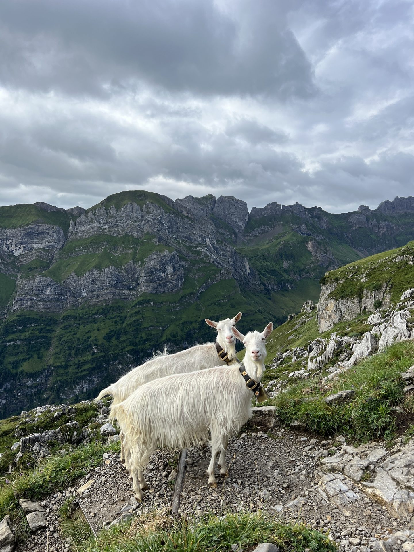
Switzerland never fails to astound me with its natural beauty, and the region of Appenzell didn’t disappoint. It is home to The Alpstein, a subgroup of the Appenzell Alps which provides an incredibly dramatic mountain landscape. This predominantly limestone massif is covered with ridges, folds and alpine lakes which are scattered with trails and mountain huts, the recipe for a perfect hiking destination.
The Nitty Gritty:
Getting There:
Appenzell is easily accessible. There are regular flights to Zurich and from there you simply hop on a 1.5 hour train to Appenzell. Swiss trains are regular, punctual and comfortable, so it’s a breeze.
Accommodation:
There are a handful of hotels, BnBs and guesthouses in the town of Appenzell itself, which would be a great option if you want to stay centrally and use the local transport links. We chose to stay in a small local Airbnb in a neighbouring town of Urnasch which can be reached by car. On our second trip to the region we stayed in this cosy airbnb which was perfectly located close to the trails.
Prices:
In case you haven’t heard, Switzerland is pretty pricey. In particular, food and transport can be expensive, so if you do choose to eat out three times a day then be prepared to splash the cash. There are definitely ways to work to a budget, but you just need to be a bit savvy.
Getting Around:
I would recommend hiring a car if you want the ultimate freedom to explore this region without worrying about public transport. However, if you base yourself in Appenzell there are regular trains and buses to the mountains.
How Long To Stay:
A long weekend is the perfect amount of time to spend in this region and really get a feel for it. However you could definitely stay for longer and explore more of the trails and mountain huts.
When To Go:
The best hiking weather is mid June through to early October, with many mountain huts opening in early July.
Top Tips:
To make your life easier I recommend printing out the local map or having it saved offline on your phone for easy access. The app SBB is great for booking and tracking local trains as well as viewing timetables. Most places take contactless but mountain huts prefer cash or inserting your card.
Hiking In Switzerland:
Switzerland is home to some of the most incredible hiking trails in the world. It is jam packed with towering mountains, crystal blue lakes, thundering waterfalls and picturesque valleys. Hiking trails are interwoven across the whole country, clearly marked with signs and connected by a comprehensive transport network. It really is the ideal place to take a hiking holiday.
If you’re new to hiking then I recommend checking out my beginners guide to hiking article to help you get to grips with the basics. Make sure that you have the local hiking map easily accessible and pack for all weathers and eventualities, even in the height of summer. We were there in August and the weather varied from bright sunshine and 32 degrees through to 10 degrees and sheets of rain. Mountain weather is notoriously unreliable and can change rapidly, literally in minutes. Be prepared.
The Best Hikes in Appenzell:
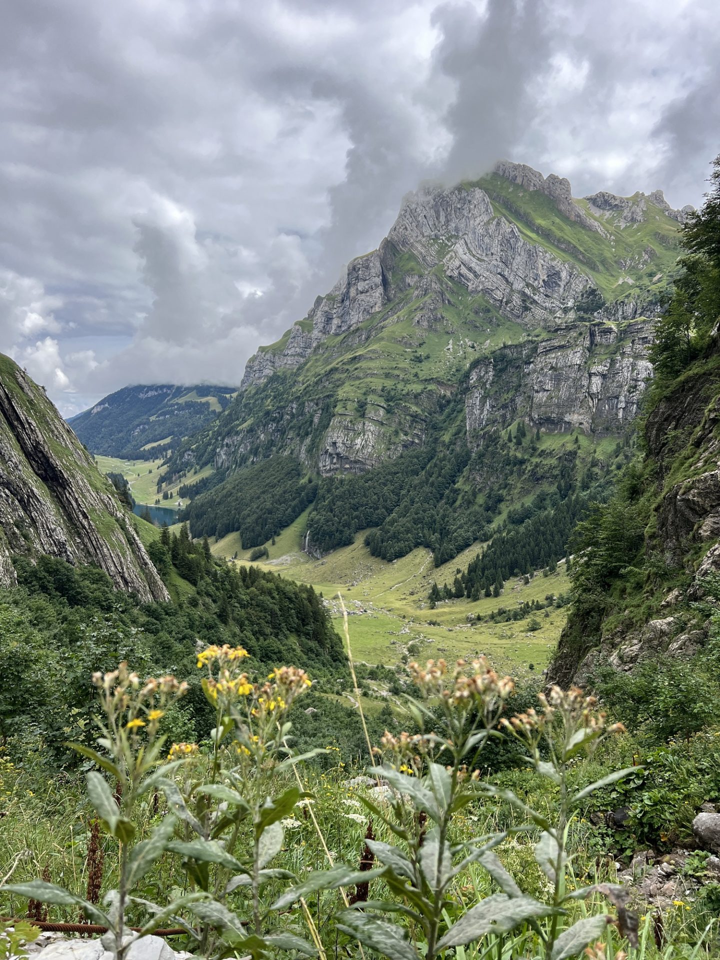
Hoher Kasten to Saxer Lucke, Falensee & Samtisersee
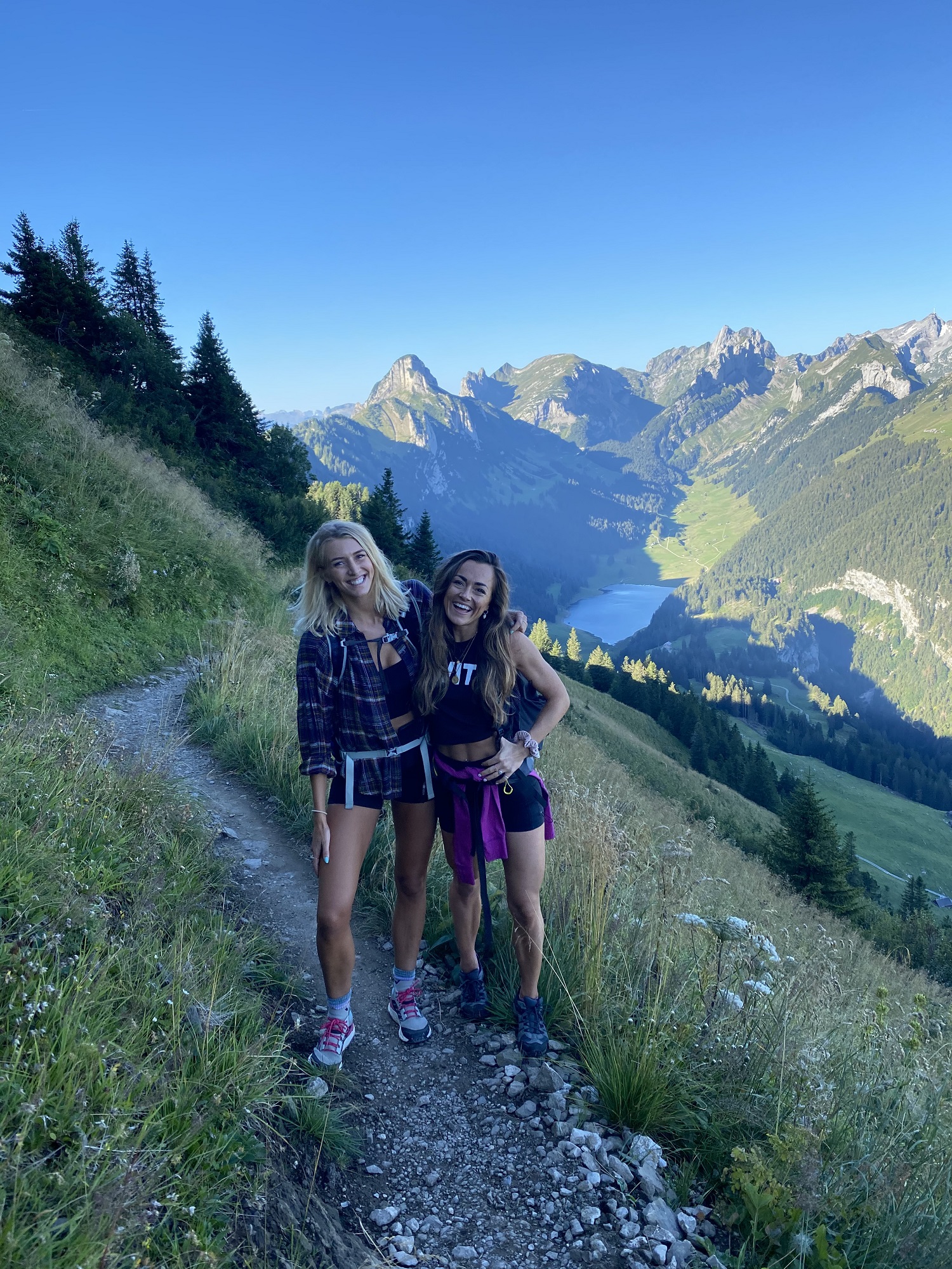
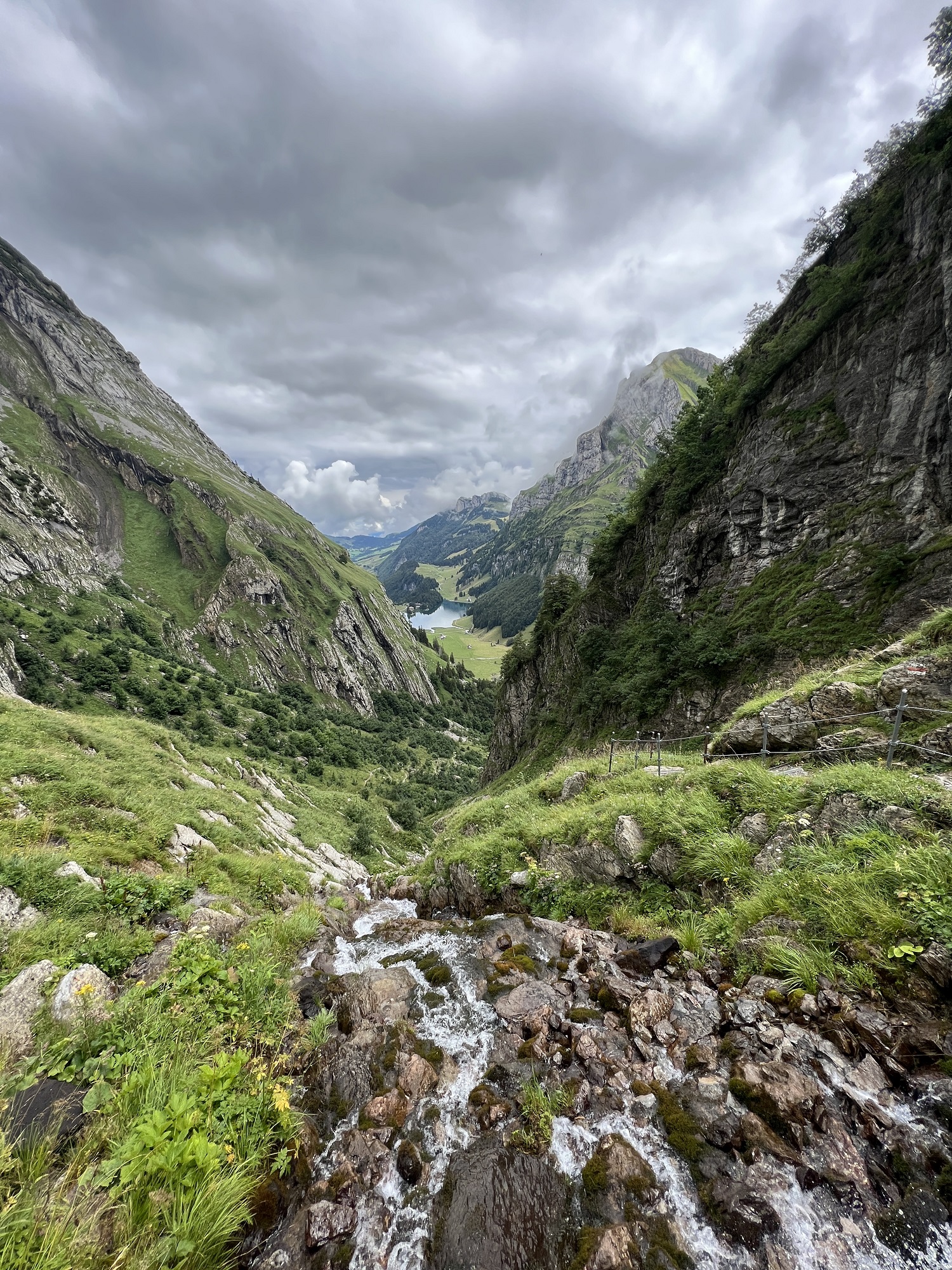
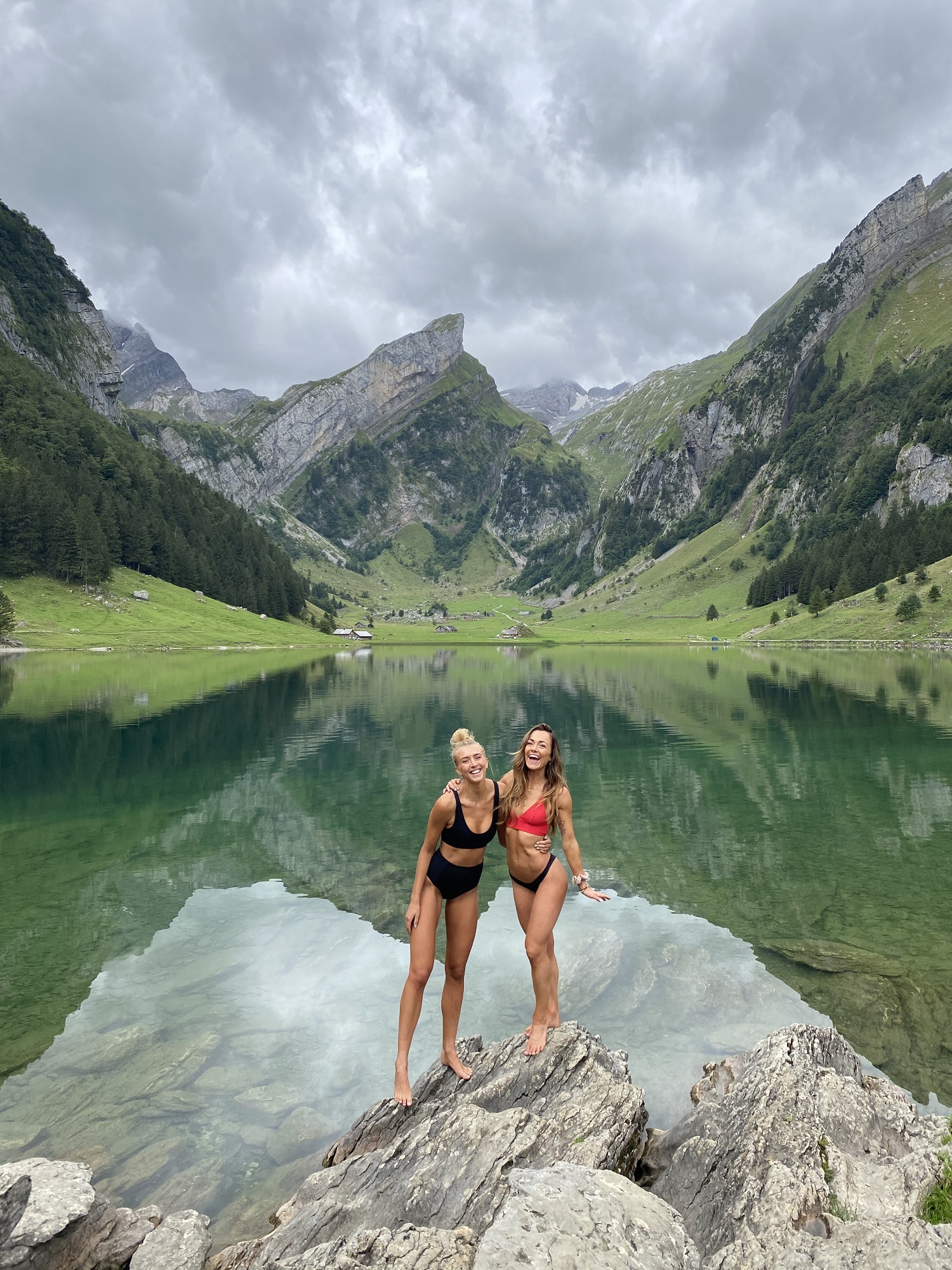
This is one seriously incredible hike. It starts following a ridge-line which overlooks the surrounding mountains and lakes, followed by incredible views of the dramatic Saxer Lucke rock formation before heading down into the valley past the crystal blue waters of Falensee and Samtisersee lakes. Here you can find a mountain hut to grab some lunch and take a mid-hike dip in the refreshing water. Personally, Lake Falensee was the highlight of the whole weekend. I have never seen a lake which is framed so perfectly by mountains. All in all, this hike gives maximum views for moderate effort – don’t miss it.
Distance: 15km
Duration: 5-7 hours depending on how many stops you make. Allow a full day if you want to relax by the lake.
Elevation: 500m gain & 1300m loss.
Difficulty: Moderate.
When To Go: June to Late September
Route Info: Catch the cable car from Brulisau to Hoher Kasten, then follow the trails to Saxer Lucke, Falensee, Samtisersee and back to Brulisau.
Ebenalp to Schafler
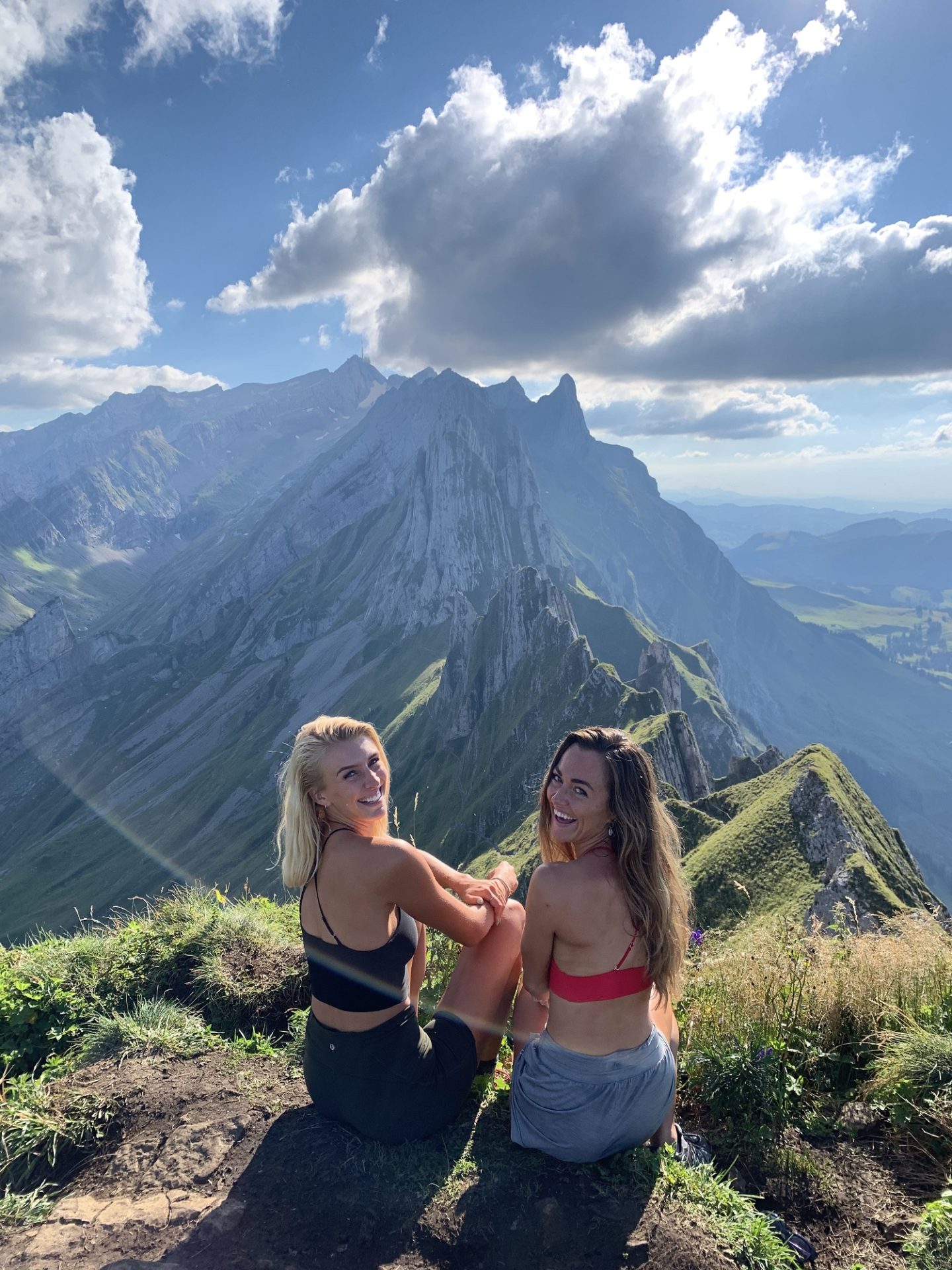
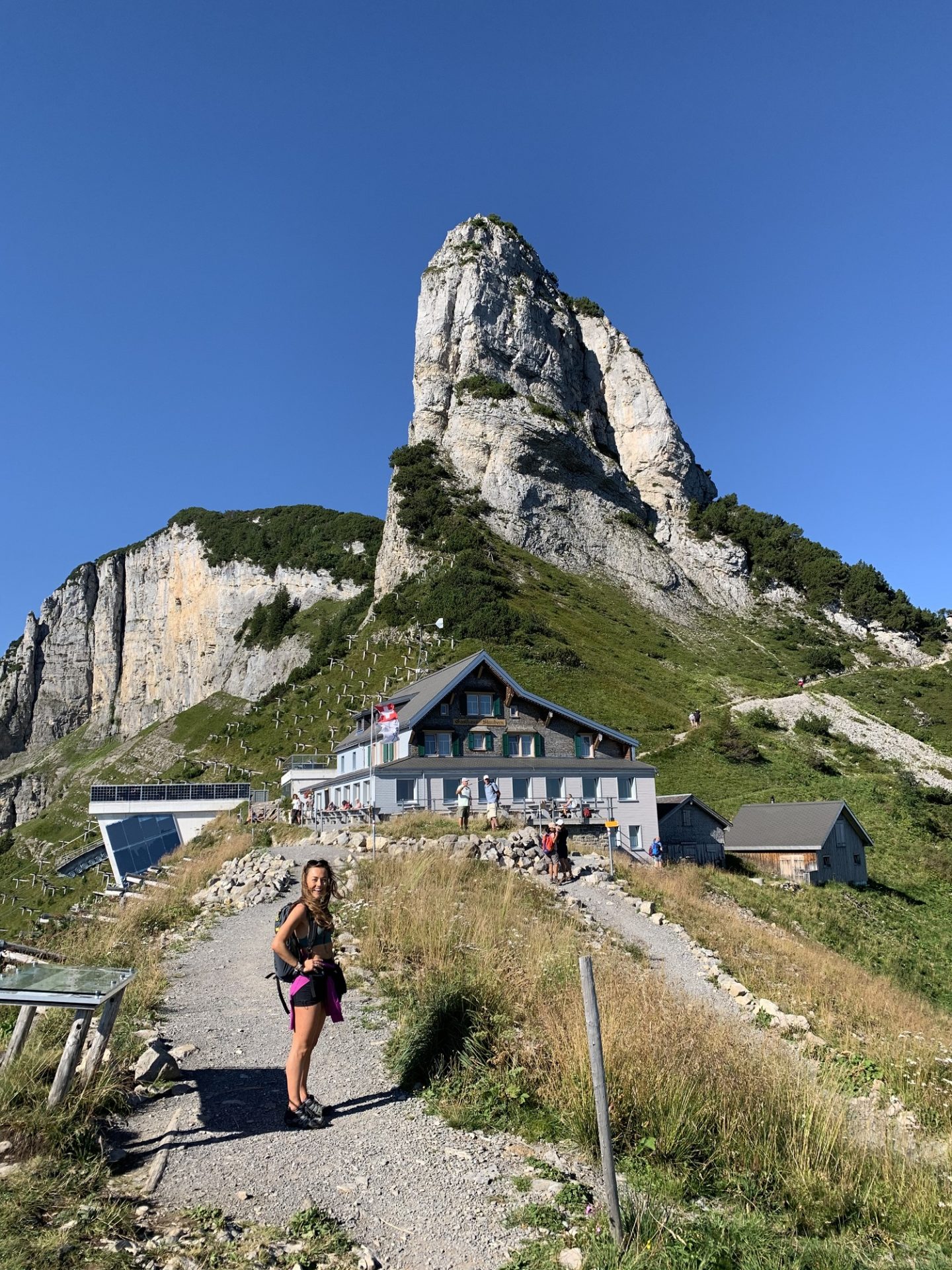
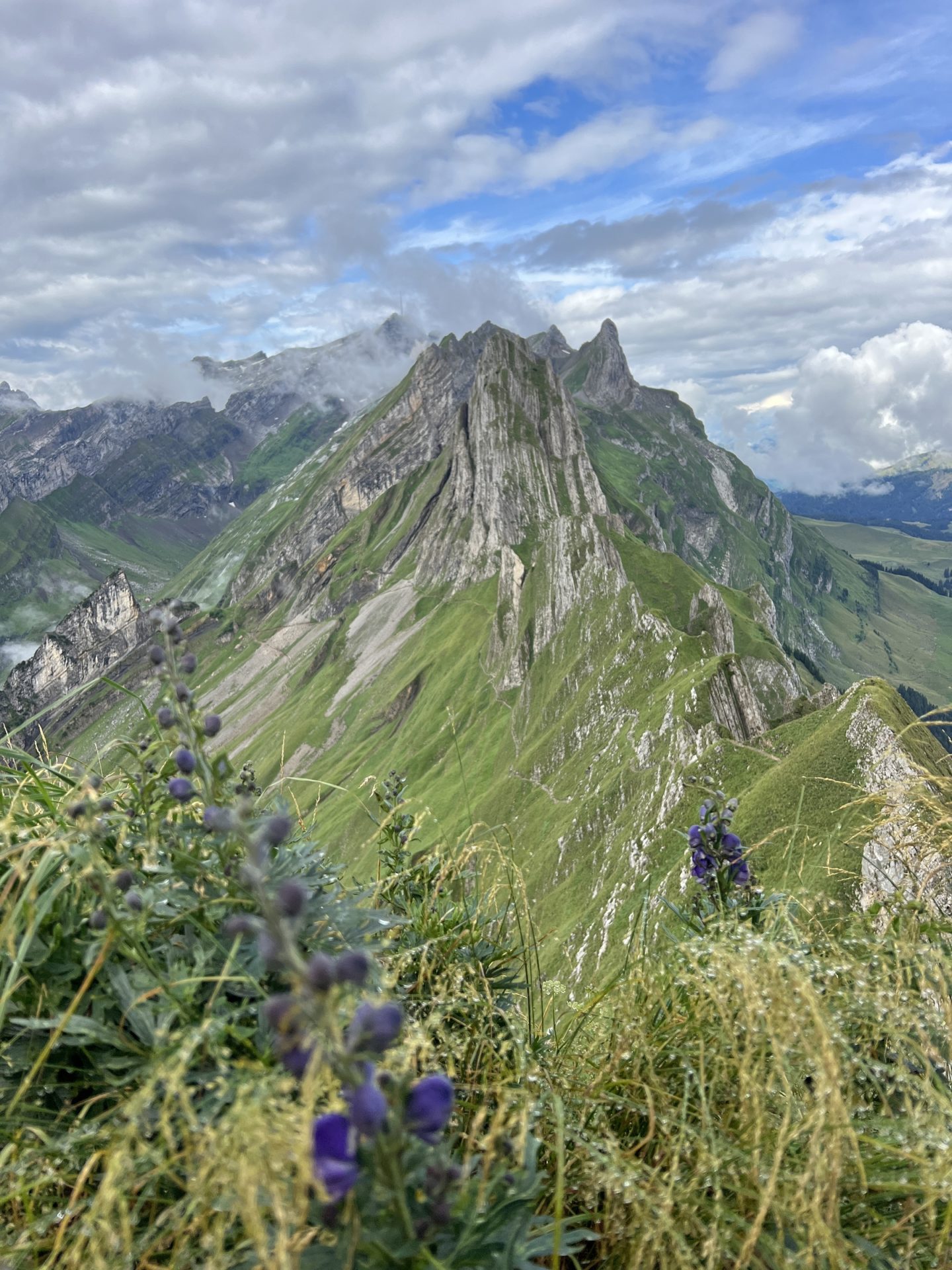
If you want a quick but satisfying hike then this short out-and-back route is for you. Schafler is one of the most famous viewpoints in the Alpstein and it is easy to see why, you overlook perhaps the most stunning ridge-line I have ever seen in my life. If you want to see mother nature in all her glory, make sure you go here!
Distance: 5km
Duration: 2 hour round trip (add more time if you want to explore the ridge-line).
Elevation: 400m.
Difficulty: Moderate.
When To Go: June to Late September.
Route Info:
The easiest route is to catch the cable car from Wasserauen to Ebenalp and then walk up to Schafler and back, before returning on the cable car. However, you can also extend this hike by hiking up from Wasserauen (which is over 1000m of elevation gain!) or for a less strenuous option, hiking back down to Wasserauen from Schafler, which is what we did.
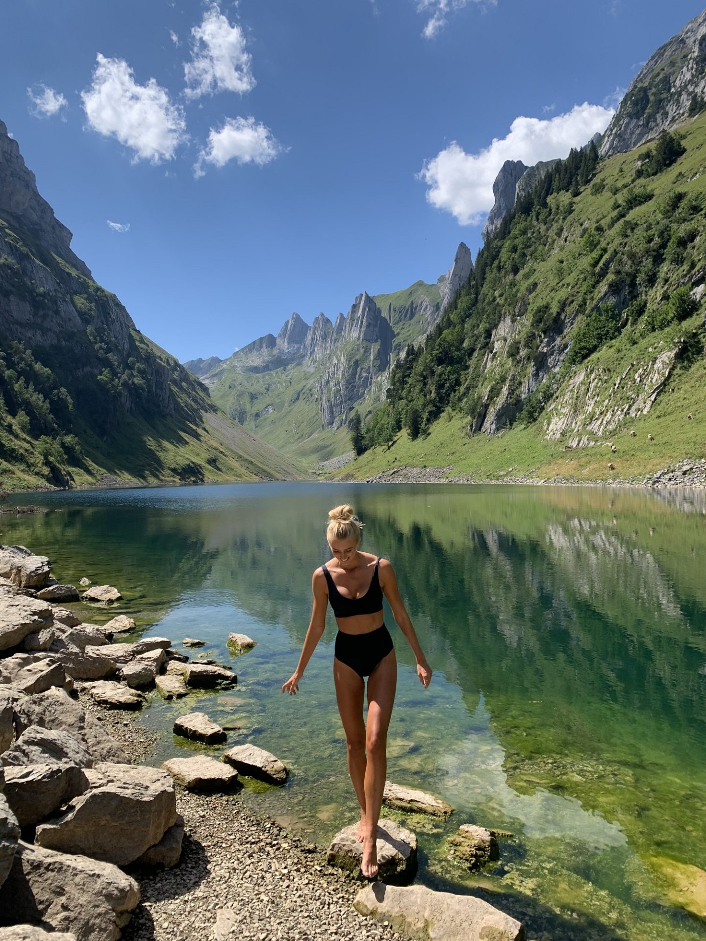
Seealpsee
Seealpsee is the most easy accessible and famous lake in the Alpstein, so I recommend setting off early to avoid the crowds. The hike up is short and challenging but totally worth it, you are rewarded with one of the most picturesque lakes in Switzerland. Crystal blue water, little wooden rowing boats and panoramic views of the Alpstein mountains. Make sure you go for a swim (warning: it’s rather cold!) and then grab a hot chocolate to warm up at one of the mountain huts next to the water.
Distance: 5km
Duration: 2 hour round trip (add more time if you want to swim & explore at the lake).
Elevation: 300m
Difficulty: Moderate.
When To Go: June to Late September.
Route Info:
From Wasserauen there are a couple of routes directly up to Seealpsee, all available on the hiking map. I have included information for the shortest one above but there are longer and more scenic options available.
The Three Lakes Hike
This challenging hike with over 1500m of elevation gain is not for the faint hearted. However, if you’re short on time and want to see all three of the beautiful lakes in the Alpstein in one day, this is the route for you! It starts in Wasserauen and ends in Brulisau, so ensure you set off early so you can catch the last bus back to Wassauren. The route is a stunner, taking in Seealpsee, Falensee and Samtiseree as well as the incredible scenery surrounding them.
Distance: 17.5km
Duration: A full day hike, around 6-8 hours+.
Elevation: 1500m
Difficulty: Hard
When To Go: June to late September
Route Info: Feel free to look at the local map and adjust the hike route based on your preferences, but I have included an example AllTrails map here.
The Lisengrat Ridge
Lisengrat is the name given to the route between Santis and Rotsteinpass/Altmann. This challenging hike is only for those with nerves of steel. It is a narrow ridge with large drops on both sides, so don’t attempt it if you’re even slightly scared of heights. There are cables and stairs to help you along the trail and you are rewarded with incredible views over the Alpstein mountains for your hard work.
Route Info: There are numerous ways to tackle this ridge, if you want to do it in a day then try catching a cable car up to Santis and then going out and back along the route. It can also be incorporated into a multi-day hike through the Alpstein, with overnight stops at the numerous mountain huts in the region.
Ebenalp, Aescher Hut, Schafler, Mesmer & Seealpsee
This is one of my favourite routes in the Alpstein. This is because it takes in the famous Aescher Hut, a stunning (and very photogenic!) hut tucked away into a mountain side, as well as the iconic Schafler Ridge, the quaint Mesmer mountain hut and beautiful crystal clear lake of Seealpsee. In short, it ticks off some of the most beautiful sights in the region!
Distance: 13.84km
Duration: 6 hours. Allow a full day for lunch stops & a swim in the lake.
Elevation: 640m
Difficulty: Moderate to Hard
When To Go: June to late September
Route Info: This loop starts off at the top of the cable car station in Wasserauen. A head for heights is required to take on the Schafler Ridge, but cables are provided for those who need something to hold onto.
I hope you have the most incredible time in the Swiss mountains. The beautiful landscapes will tire out your legs but fill up your soul.
Safe travels,
Zanna
Did you like this blog post? Check out my other Switzerland guides:
GSTAAD SUMMER TRAVEL GUIDE: 4 DAY ITINERARY
ZURICH – AN ACTIVE TRAVEL GUIDE
